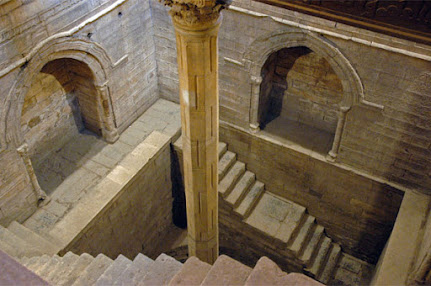
The Nubian Sandstone Aquifer System
Welcome to this 'water and environmental change' blog series.
This blog discusses the relationship between water and environmental change in Africa, focusing on key examples from different regions in Africa. I will attempt to convey the connection between human and natural processes on the availability and distribution of water within the African continent, drawing on both past and current events whilst also recognising the political context in which these events occur.
The main background topics from which I will draw my knowledge will be the climate, groundwater and hydrological sciences as these sub-disciplines of physical geography are closely interconnected.
The first series of blogs will focus on North Africa, and this post will discuss the environmental change associated with the groundwater extraction of the Nubian Sandstone Aquifer System.
The Nubian Aquifer System spans over 2 million square kilometres across Sudan, Chad, Libya and Egypt, containing upward estimates of 178,000 cubic kilometres of groundwater (CEDARE, 2000).
Figure 1: Map of the Nubian Aquifer system and the underlying geology (Mohamed et al, 2016).
The aquifer system is built upon permeable Paleozoic and Mesozoic sandstone and bounded by impermeable outcrops on all sides except the North, where the saltwater interface reaches the aquifer system (Hesse et al, 1987). The system is primarily recharged via the precipitation occurring in the Sudanese and Chad highlands and periods of intense rainfall in the region. The system was primarily built up during wet climactic periods in the Sahara, with major recharge occurring during the Quaternary (Sultan et al, 2011).
The aquifer system sustains many development projects within the North Africa region, the most notable being the Great Man-Made River (GMMR) in Libya and the land reclamation projects in Egypt, used primarily for agricultural use. These two projects are of great interest due to the vast groundwater extraction occurring and their specific geographical location within the aquifer system. The GMMR is located in Southeastern Libya and extracts from the Kufra portion of the aquifer, whereas the Egyptian land reclamation projects are located in proximity Tushka and Aswan, and extract from the Dakhla portion of the aquifer.
The GMMR extracts up to 2.4 cubic kilometres of water per year from the aquifer, however minimal groundwater depletion has occurred during the past decade, whereas the Dakhla region has experienced significant groundwater depletion, up to 100mm difference in terrestrial water storage values, as indicated in figure 2.
This groundwater depletion has had significant implications for local environmental change, primarily through the extraction of the groundwater supplying the land reclamation and transforming arid land into arable land, however the depletion has caused increased desertification both upstream and downstream as the groundwater gradient increases in order to fulfil the extraction requirements. The groundwater extraction has also resulted in a gradual decrease in elevation and due to the high evapotranspiration rates of the region, salinisation poses a significant threat to the local environment.
Figure 3: Basement level relief map showing the separation of the Nubian Aquifer system by the impermeable Uweinat outcrop (Mohamed at al, 2016).
The reason for the discrepancy in TWS & GWS values over time between the 2 locations is likely due to the Uweinat basement outcrop that splits the aquifer system into 2 distinct blocks. This basement outcrop joins the Sudanese highlands, visible in figure 3. This outcrop drops directly into the large basin that drains into Kufra, therefore most of the recharge is directed into the Kufra basin whilst the Daklha region will experience lower levels of recharge from the highland precipitation.
The Nubian Sandstone Aquifer system is a prime example of how both natural and anthropogenic factors related to groundwater will affect the local environment, and that these phenomena operate within a constantly changing system.


Great synthesis of content and resources on your topic! That said, I think you can strengthen the first paragraph by adding a bit more about the main focus of your post - what do you want the reader to know? Also, provide a bit more on the significance of your argument - why is it important for the reader to know? You can then add a line or two to reflect on the argument and what you have covered in the post.
ReplyDeleteWrite in the first person/active voice. It will help you to bring out your narrative or 'voice' more.
Please add your references as hyperlinks. If you are unsure about how to do this, please see the FAQs Task 1.1. on Moodle.
(GEOG0036 PGTA)